What Medieval Streets?
Two years ago, I was having lunch at my neighbourhood bistro and struck up a conversation with a middle-aged Parisian woman next to me. She asked me what I had seen in Paris, and I mentioned that I was interested in finding medieval streets that had escaped Haussmann’s bulldozer. I gave her a couple of examples — Rue des Barres, Rue de Nevers — and she shook her head sadly. “A structure here and here, yes,” she said. “And some ancient streets may lie along their original paths. But even individual buildings are very rarely medieval. Quel dommage!”
When I speak with Parisians about medieval Paris, I sense their regret that Haussmann didn’t spare at least one medieval quartier. The desire to preserve is mingled with nostalgia. Paris regrets its great erasures, such as medieval Paris and Baltard’s market pavilions at Les Halles. Paris likes to see where she came from, and to incorporate that somehow into her new vision. With modern running water and sewage disposal, of course.
With the caveat, then, that medieval Paris streets — in the sense of stretches of original structures — are illusory . . .
Right Bank — A Wedge of Medieval Marais
The paths of several medieval streets somehow escaped Haussmann’s reconfiguration in the area of the Marais just east of l’Hôtel de Ville. It’s an ancient wedge of Paris, a solid little hamlet boasting two baroque churches, notable hôtels particuliers, a section of Philippe-Auguste Wall, and Village St-Paul, among other treasures.
Rue Charlemagne
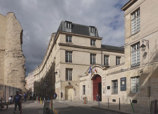
One of my favourite places in Paris is Rue Charlemagne in that same “hamlet” in the Marias. The construction of the street in the mid-14th century cut through the Philippe Auguste Wall. Ruins of that wall nonetheless survive as the ruined Montgomery Tower on Rue Charlemagne as well as the longest stretch of the wall in Paris, along the perpendicular Rue des Jardins St-Paul. To the left in the image below is the ruined tower of the ancient wall and to the right, the entrance to Lycée Charlemagne, a middle and high school (formerly a medieval residence for Jesuits):
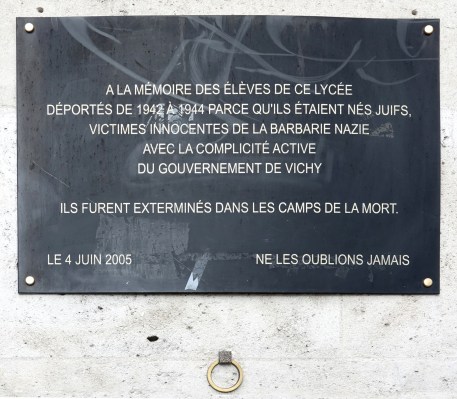
Memorial plaque at the entrance to Lycée Charlemagne acknowledging the deportation from 1942-1944 of Jewish students to death camps, “innocent victims of Nazi barbarism, with the active complicity of the Vichy Government”:
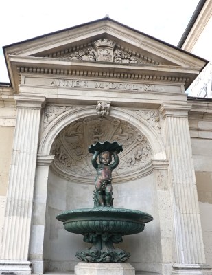
19th-century fountain to the right of Lycée Charlemagne:
Rue des Barres
Rue des Barres dates back at least to the 13th century. Located near Pont Louis-Philippe, the street starts at the Seine, along which mills operated, owned by the Templars. At that time in the 13th century, the street was called Ruelle des Moulins-du-Temple (Lane of the Templars’ Mills).
Rue des Barres leads past the baroque Église Saint-Gervais Saint-Protais. It’s also steps away from the Mémorial de la Shoah.
Rue Cloche Perce
Located just around the corner of the side-by-side half-timber houses on Rue François-Miron . . .
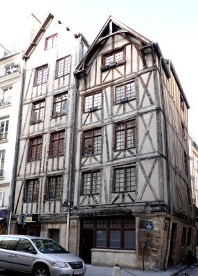
. . . is a narrow cobblestone lane created before 1250.
A claustrophobic medieval atmosphere enshrouds the short Rue Cloche Perce (Street of the Persian-blue Bell). It is sometimes called Rue Cloche Percée (Street of the Pierced Bell). The street was supposedly named after a bygone shop sign — but did that sign bear the image of a Persian-blue bell? Or a pierced bell? The debate rages even today.
Left Bank
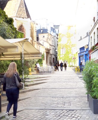
Rue Mouffetard — from Neolithic to gentrified

Rue Mouffetard has medieval roots, but it goes back farther to Gallo-Roman times, when it continued southward toward Italy and ultimately, Rome. It’s more ancient yet: the Romans lay stones along a Neolithic lane. Thousands of years later, here we are:

Rue Mouffetard and adjacent areas have seen the renovation of formerly working class residences and neighbourhoods, and the escalation of housing costs.
A couple of passages off Rue Mouffetard:

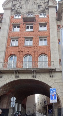
Below: The ornate facade on Rue Mouffetard was in effect an advertisement for the 1930s boucherie at ground level.
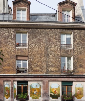
The animals seem to be ensnared in the decorative geometric “net.” This unique work was created using a pottery technique called “sgraffito” (It. scratch), in which a tool is scraped along a surface to reveal a different hue beneath it.

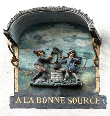
A cheeky 17th-century advertisement:
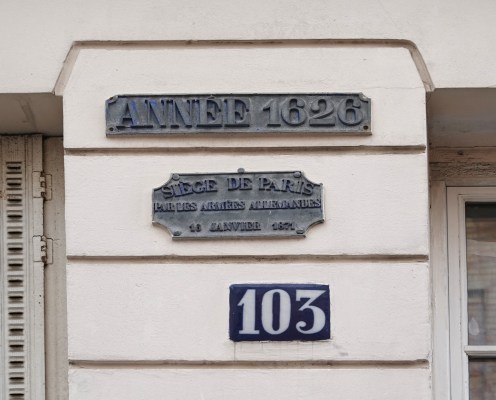
Plaque commemorating the Prussian siege of Paris, January 17, 1871:
Aside: Near Rue Mouffetard, at 6 Rue du Pot de Fer, resided the twenty-something George Orwell from 1928 to 1929 during his slumming adventures in Paris, living in extreme poverty and working as a dishwasher (plongeur) for a restaurant. He related his experiences in his memoir Down and Out in Paris and London.

Orwell’s description of washing dishes for a living:
[A] plongeur is one of the slaves of the modern world. . . . His work is servile and without art; he is paid just enough to keep him alive; his only holiday is the sack. . . . [He has] been trapped by a routine which makes thought impossible. If plongeurs thought at all, they would long ago have formed a labour union and gone on strike for better treatment. But they do not think, because they have no leisure for it; their life has made slaves of them.
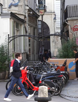
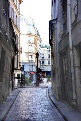
Rue de Nevers
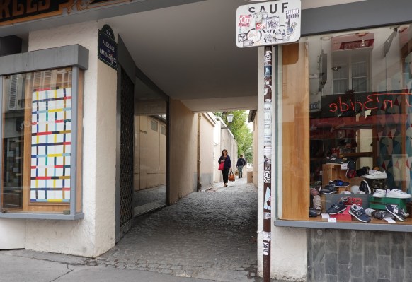
Pont Neuf, completed in the early 17th century, leads directly to the short medieval lane of Rue de Nevers.
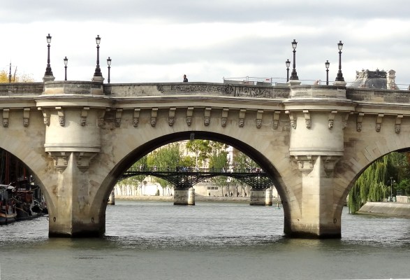
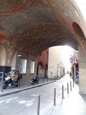
The edifice through which one passes to enter the lane is a drum roll from the 17th century — in reality, a counterfeit. During the early 1930s, architect Joseph Marrast was commissioned to design Carrefour Curie, a residential building with a portico entrance to the Rue de Nevers. The structure was to reflect the architectural style of the 17th century, but the concrete archway and the style of the frieze at the top betray its more recent age.
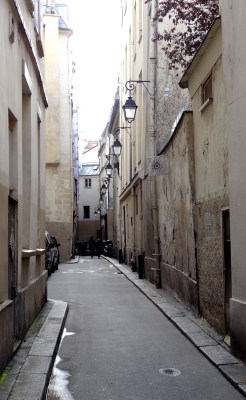
On the ceiling of the concrete archway is inscribed a 17th-century scatalogical poem by Claude Le Petit. The poète maudit satirizes Pont Neuf — the rogues and dupes who gathered on the bridge and the sewage-laden waters of the Seine that flowed under it.
At its inception in the 13th century, Rue de Nevers functioned as a back alley, connecting services to the rear of a monastery. A rut along the lane carried sewage from the monastery to the Seine. It still looks like a back alley, but contemporary eyes and noses might regard it as a quaint one.
Rue de Bièvre
Rue de Bièvre existed at least as far back as the Middle Ages:
This street follows the path of the Bièvre River (now covered over). Pre-Haussmann, the waterway was something of a sewer and a dumping place for the tanneries and laundries that lined it. When I was there, I could picture Paris’ polluted little river flowing where a street now lies. As to the edifices on either side, until recently I had been content to believe that at least some of them were medieval.
Next: Hybrids at the Cusp of the Renaissance
Camille Martin
